This weekend the "Race to the sun", the 71st edition of Paris-Nice, will already start in Houilles with an extremely short prologue and for a total distance of 1,174 kilometers up to the Col d'Eze including of course a visit of the inevitable Promenade des Anglais in Nice.
In this article you'll find as usual the detailed race route of Paris-Nice 2013 on Google Maps/Google Earth, but also the time- and route schedules and the profiles of the different stages which make up this race.
The Paris-Nice 2013 race route on Google Maps
You're about to discover the detailed race route for Paris-Nice 2013 including all important points of the different stages, the exact locations of starts, finishes, sprints and climbs but also the exact route followed between the fictive start and the real start of these stages.CONTINUE READING AFTER THIS ADVERTISEMENT
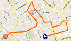
P/ Sunday 3 March 2013 - Houilles > Houilles - 2.9 km
It'll all start with an extremely short prologue, 2.9 kilometers in the streets of Houilles, just at the outskirts of Paris in the Yvelines department.After a start on the Place du 14 juillet, the riders will follow the Avenue du Maréchal Foch, Rue Honoré de Balzac, Rue Gabriel Péri, Avenue du Maréchal Maunoury, Avenue Schoelcher, Avenue de la République, Rue Gabriel Péri, Rue de l'Eglise, Rue Camille Pelletan, Rue de Lorraine, Rue du Maréchal Galliéni and finally the Rue de la Marne which will bring them towards the white line which will be drawn on the road in the Rue du Président Kennedy. To get there, they'll have to negociate about 10 turns in the quest for the first yellow jersey of this 71st edition of Paris-Nice.
Hereunder you'll find the time- and route schedule, the stage profile and the map with the race route of this stage. Click on the different images to open them.


1/ Monday 4 March 2013 - Saint-Germain-en-Laye > Nemours - 195 km
The first stage will start close to Houilles, in Saint-Germain-en-Laye for a 195 kilometer long flat stage.After a first short incursion westwards up to Beynes, the peloton turns south-east via Rambouillet, Etampes - where they'll find the feeding zone of this first stage and Malesherbes where they'll battle for the first intermediate sprint of Paris-Nice 2013.
A bit under 5 kilometers further, the riders will arrive on top of the Côte de Buthiers, a 500 meter long 4th category climb at 4.2% culminating at 107 meters.
From there, they'll still have 75 kilometers to go, not to get to the finish city but till the final finish and the crossing of the finish line. Indeed, a first visit of Nemours will be with still 47 kilometers to go, but just before they cross the white line drawn in the Rue de Paris, the riders will turn right for one lap on a circuit around the city, which includes another intermediate sprint in La Madeleine-sur-Loing.
( Specific comment for those who would read the roadbook of the race provided by the organisor: the detailed map of the finish is not correct. Indeed, the race arrives at the finish from the Avenue Carnot / D607 and not from the Rue de Larchant / D16. The last turn before the finish is thus much closer than what one could think when taking a look at the roadbook. )


2/ Tuesday 5 March 2013 - Vimory > Cérilly - 200.5 km
Another stage with a quite flat race route will be on the programme this Tuesday 5 March, between Vimory and Cérilly, a bit over 200 kilometers south.Indeed, this stage follows an almost straight line between the start and finish and crosses Gien, the start city of Paris-Bourges, but just before they get there the riders will dispute the first intermediate sprint of this stage, in Les Choux.
In Montigny the riders can get some forces in the feeding zone before they head to the finish in Cérilly, where they'll discover the very long final straight line of no less than 4 kilometers which brings them to the finish. For a first discovery to start with, because at the first crossing of the finish line they'll only battle for an intermediate sprint. A 18 kilometer long circuit will bring them via the Etang de Pirot and the forest around Cérilly back to the same final long line towards the finish.


3/ Wednesday 6 March 2013 - Châtel-Guyon > Brioude - 170.5 km
The 3rd stage of Paris-Nice 2013 will cross, from the start in Châtel-Guyon, the Auvergne region from north to south but doesn't forget to bring a visit from west to east turning around Clermont-Ferrand, Pont-du-Château and Thiers before the peloton starts its descent towards Brioude.In this first part, the riders will find an intermediate sprint in Joze, after 34 kilometers in the race.
This stage will be a little bit more hilly because after the feeding zone in Billom, the riders will climb the Col de Potey (3rd category, 3.3 km at 5%) followed by the Côte de la Forêt de la Comté (also 3rd category, 3.5 km at 3.8%) 10 kilometers further.
From there, they'll go straight towards Brioude where they'll dispute an intermediate sprint but won't cross the finish line. Before they get there they'll turn right for the start of the last 30 kilometers of the stage. In the loop which will bring them back to Brioude they'll have to climb the Côte de Mauvagnat, a 2nd category climb of 2.7 kilometers at 6.7%.
The finish will be in the Avenue Léon Blum close to the Place Champanne.


CONTINUE READING AFTER THIS ADVERTISEMENT
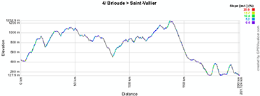
4/ Thursday 7 March 2013 - Brioude > Saint-Vallier - 199.5 km
This 4th stage will be a little bit under 200 kilometers long and will be the first stage which takes a west-east direction from the start in Brioude (where a stage towards Aurillac started for the Tour de France in 2008).This stage will be a little bit more hilly and will start immediately from the start in Brioude with the climb of the Côte de Lachaud (2nd category, 4.8 km long at 5.6%). After the descent of this climb, the peloton will climb even higher, towards the top of the Côte de Condat at 1,035 meters altitude. This is also a 2nd category climb, 6.9 km long at 4.4%.
This will be followed by a descending part, with an intermediate sprint intermédiaire in Craponne-sur-Arzon and the feeding zone in Retournac.
3 other climbs, of the 3rd category this time, will follow: the Côte de la Chomasse (3.4 km at 5.1%), the Côte de Laprat (2.1 km at 3.8%) and a bit further the Col du Rouvey (2.8 km at 5.6%).
Via the intermediate sprint of Saint-Romain-d'Ay they'll get to the foot of the Côte de Talencieux, 2nd category, 2.9 km long at 8.1%. A new descent further, they'll start the climb of the Côte de la Sizeranne, also 2nd category and with the same length, at 6.6%. It's summit will be at about 8 kilometers from the finish in Saint-Vallier, where the finish line will be drawn in the Avenue Eugène Buissonnet.


5/ Friday 8 March 2013 - Châteauneuf-du-Pape > La Montagne de Lure - 176 km
This Friday the queen stage of the 71th Paris-Nice will be on the programme.It'll all start calmly after the start in the Avenue Baron Le Roy in Châteauneuf-du-Pape via Monteux and Pernes-les-Fontaines before the start of the climb of the Col de Murs (2nd category, 10.3 km at 4.3%). The descent will lead to the intermediate sprint in Saint-Saturnin-lès-Apt.
Still going east, they'll arrive about twenty kilometers further on top of the Côte d'Oppedette, 2nd category climb of 7.1 km at 4%.
The riders will than get in the feeding zone in Simiane-la-Rotonde and will continue north up to the entrance of Banon where they'll go back south towards Manosque, with the climb of two 3rd category climbs, the Côte de Saint-Martin-les-Eaux (2.7 km at 3.7%) before Manosque and the Col de la Mort d'Imbert (4.5 km at 4.4%) after the city.
After the sprint in Forcalquier, the Côte des Mourres (3rd category of 2.9 km at 4.9%) will only be a starter for the final climb towards the Montagne de Lure where the finish will be at 1,600 meters altitude on this first category climb of 13.8 kilometers at 6.6%.


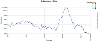
6/ Saturday 9 March 2013 - Manosque > Nice - 220 km
The forelast day of Paris-Nice 2013 will see the longuest stage of the race, with 220 kilometers between the Parking du Lycée des Iscles in Manosque and the famous Promenade des Anglais in Nice.This stage immediately starts with the climb of the Côte du Bois de Rousset, 3rd category climb of 4.4 km at 4.5%. The first half of the stage will be slightly hilly and will bring the riders via the intermediate sprint in Flayosc to the climb of the Côte des Tuilières behind Draguignan which forms with its 2.2 kilometers at 7.8% a 2nd category climb.
After the feeding zone in Figanières another climb, 3rd category, is waiting for the riders, the Côte du Mont Méaulx (1.7 km at 4.3%).
About thirty kilometers will allow them to keep on rolling a bit more calmly before they start the climb of two consecutive 1st category climbs, the Côte de Cabris (7.6 km at 5.8%) which goes on in the climb of the Col du Ferrier (4.3 km at 6.8%).
After the descent, a short climb towards Tourrettes-sur-Loup allows to take some additional points for the points classification in the final intermediate sprint. The riders will than start the descent towards Nice with a last part of about twenty kilometers which will be completely flat.


7/ Sunday 10 March 2013 - Nice > Col d'Eze - individual time trial - 9.6 km
The very last stage of this Paris-Nice will be identical to the one we saw last year and which brought back the historical time trial between Nice and the Col d'Eze. With a distance of no more than 9.6 kilometers, this time trial can however be decisive for the general classification of this Paris-Nice 2013 because only the riders who know how to combine good time trial qualities and climber qualities will have a chance to get a good ranking in this time trial and thus be able to defend their position in the general classification and get on the podium at the end of the race. It'll be two hours later than last year, at 1.40PM, that the first rider will start the ascent of the Col d'Eze while the last rider is attended on top at about 4.45PM!An intermediate timing point will be on the Col des Quatre Chemins.


The Paris-Nice 2013 race route in Google Earth
You have just discovered all details of the race route of the 71st edition of Paris-Nice, including the time- and route schedules, the stage profiles and the maps of the race route on Google Maps for each of the stages. If you'd like to see the whole Paris-Nice 2013 race route in one glance, you can download the KML file below and open it in Google Earth:>> Download the Paris-Nice 2013 race route in Google Earth (KML file)
This file will also allow you to do a virtual fly-over of one or more of the stages of Paris-Nice 2013.

In the different maps on Google Maps presented earlier in this article or in Google Earth you can click on the icons shown on the map to get access to more details about the start and finish locations, about the sprints, the feeding zones and the climbs. door Thomas Vergouwen
Vond u dit artikel interessant? Laat het uw vrienden op Facebook weten door op de buttons hieronder te klikken!
1 comment | 14132 views
this publication is published in: Paris-Nice | Paris-Nice 2013 | OpenStreetMap/Google Maps/Google Earth


 by Mia over
  by marco1988 over
site bien documenté